


Over the past few years, there’s been an awakening of sorts within my scope of reporting and documenting cycling: when I travel to cover an event, or set out to ride in even a familiar landscape, I like to know the geopolitical, geographical, and geological history of the land in which I’ll be pedaling across, over and through. As much as this awareness contributes to a better understanding of the land we all recreate on, it’s also a way to pay respects to the prior inhabitants of these fragile landscapes.
This interest in the background and history of a place was a large motivation for me to take part in the Ruta del Jefe: a race through the San Rafael Valley, and Santa Rita Mountains, coordinated by Sarah Swallow. Last weekend, the race went down, and up for that matter, all around the San Rafael Valley, but the weekend had much more on the agenda than just riding bikes: it was a lesson for us all in how to sustainably use the land and how we could offer up our recreation as a resource.

“The earth is not dying, it is being killed, and those who are killing it have names and addresses.” Utah Phillips
The Geopolitical and Geomorphic Landscape
Just as cyclists like to pedal through the rolling hills, over mountain passes, and through the canyons of the San Rafael Valley and surrounding landscapes, there are other humans embarking on much more treacherous, and sometimes deadly, journeys. In addition, the United States’ immigration policies and proposed mining operations are greatly affecting the future of the Santa Rita and Patagonia Mountains, as well as the San Rafael Valley. These Sky Islands – or mountains isolated by large, vast, expanses of deserts – within the Sonoran Desert are home to rich biodiversity and varying ecotones.
Within each mountain, is a lush, biodiverse network of flora and fauna that have evolved to co-exist within the biomass. Within the crevices, schisms, plutons, and outcroppings, you’ll spot hundreds of bird, reptile, and mammal species, ranging from various rattlesnakes, desert box turtles, pronghorn, javelina, bobcat, black bear, jackrabbits, and even an American jaguar, of which this race is named for.
The Ruta del Jefe is a tour of one of these unique Sky Islands: the Santa Rita Mountains, specifically, Mount Wrightson, while offering sweeping vistas of the neighboring Mount Whetstone and Mount Baboquivary.
This race takes place on sacred lands that are as fragile as they are beautiful, in a time when politics might very well put it all at risk. It is of the utmost importance for an event like the Ruta del Jefe to use bicycle racing as a launchpad for bringing these geopolitical landscapes to the forefront. Within this region, there are three main concerns, of which all were discussed by representatives of the land:

El Jefe and the Northern Jaguar Project
El Jefe, which translates to the Boss, is a prominent figure in the Northern Jaguar Project’s agenda. El Jefe is the last of the known remaining American jaguars in the United States. He was first recorded in November 2011 as living in the Santa Rita Mountains. From November 2011 to November 2016, El Jefe was the only wild jaguar verified to live in the United States. That, like El Jefe, is pretty wild!
The Northern Jaguar Project monitors the presence of Jaguars both north and south of the border and studies these unique animals in Mexico’s Northern Jaguar Reserve. Once El Jefe was documented in 2011, the team set up trail cameras and began tracking El Jefe’s movements. Unfortunately, over the past few years, El Jefe’s trail has gone cold. This does not point to the demise of El Jefe, however, as other jaguars have been known to disappear for years at a time. Has El Jefe left the Santa Ritas? Or has he gone south of the border to seek a mate? This very migratory nature could be put at risk by the Border Wall:
Read more at Northern Jaguar Project.

Border Wall / No More Deaths
Executive Order 13767 calls for a large wall to be built along the border of this region and will have a detrimental impact on many migratory species. With this issue at the forefront of nature conservationists, human rights activists are pursuing a related, but different battle. This region is a border-crossing corridor and happens to fall smack dab in the middle of the US immigration debate. The current administration’s approach to the humanitarian crisis is to villanize the undocumented immigrants, in hopes of swaying public opinion to further justify their “Prevention Through Deterrence” strategy. This plan of action utilizes patrolling and placing border checkpoints strategically, forcing undocumented foot traffic into hostile terrain where water and shelter from the elements are not as abundant.
With the majority of undocumented, cross-country traffic now falling into the rugged terrain of the Sonoran Desert, No More Deaths has implemented water drops to aid in these caravans. Recent videos showcase emboldened border guards slashing water cache jugs and removing food items such as canned beans under the guise of “removing litter.”
So far, 2,800 documented deaths have occurred in the borderlands since 2001. This is regarded as a gross undercount since much of the foot traffic now falls within wilderness areas impenetrable by vehicles.
Read more at No More Deaths.

Season and Ceremony
Before the United States, indigenous people would cross between what is now the U.S. and Mexican border depending on the seasons, the weather, and tribal ceremonies. The Tohono O’odham Nation still, to this day, traverse the zone in observance of their traditions. Before all this political turmoil, the Gadsden Purchase in 1854 solidified the United States and Mexico’s territories, subsequently dividing the Tohono O’odham Nation in half, making interstate, or in this case, international travel more difficult. Seventy-five miles of the southern border of the Tohono O’odham Nation’s border happens to coincide with the United States-Mexico border. The Tohono O’odham Nation Reservation is the second largest in the United States and still to this day, members of the nation cross the border to visit family members and sacred sites as they have for thousands of years before borders, before walls, and before settlers.
Rosemont Mine
With such beauty, comes a land rich in minerals, formed throughout the Pleistocene era, and invaluable to today’s modern, tech-centric life. If you have a phone, laptop, smart car, or another piece of technology, then you use copper, the official mineral of Arizona. The problem with copper is that the easiest, yet most intrusive way to extract it is through pit mines. Early copper mines were dug into the sides of mountains through a series of shafts; the lesser-environmentally detrimental manner of mining. Yet modern approaches to copper mining results in large, gaping pits, and the poisoning of the water table, of which the city of Tucson and other towns rely on.
Not to mention our hero for which this race is named for, El Jefe, calls the potential future home of the Rosemont Mine his home. Under the Endangered Species Act, El Jefe’s domain is protected from such development, yet that protection is being tested by Hudbay Minerals Inc, the Canadian mining and mineral company. The Rosemont Mine’s proposed site is just north of Box Canyon Road along the race course for Ruta del Jefe.
Read more at Scenic Santa Ritas.

Reportage
Our home base for the weekend was the Appleton-Whittell Research Ranch. An Audubon facility, the ranch welcomes everyone from birders to bikepackers to stay in this veritable oasis and learn about the land in which the ranch calls home. Since acquiring the land in 1985, the ranch has taken measures to remove almost all of the invasive grasses common to the American Southwest, allowing the many local species of native grass to once again thrive. As participants in Ruta del Jefe, we were given access to the grounds and facilities, including on-site camping and the use of the kitchen, where Benedict – aka Ultra Romance – cooked meals for us throughout the weekend.
Arriving at the ranch the day before the race was a breathtaking experience. Rolling grasslands and a red soil 4×4 road welcomed us to the compound, nestled in the San Rafael Valley. We set up camp and began to mingle with the other racers. That evening, we were all invited to listen and engage with a series of presentations from the Audubon Society, Save the Santa Ritas, the Northern Jaguar Project, and No More Deaths. It was an insightful and powerful way to end the day and provided plenty of reflection for the day to come.

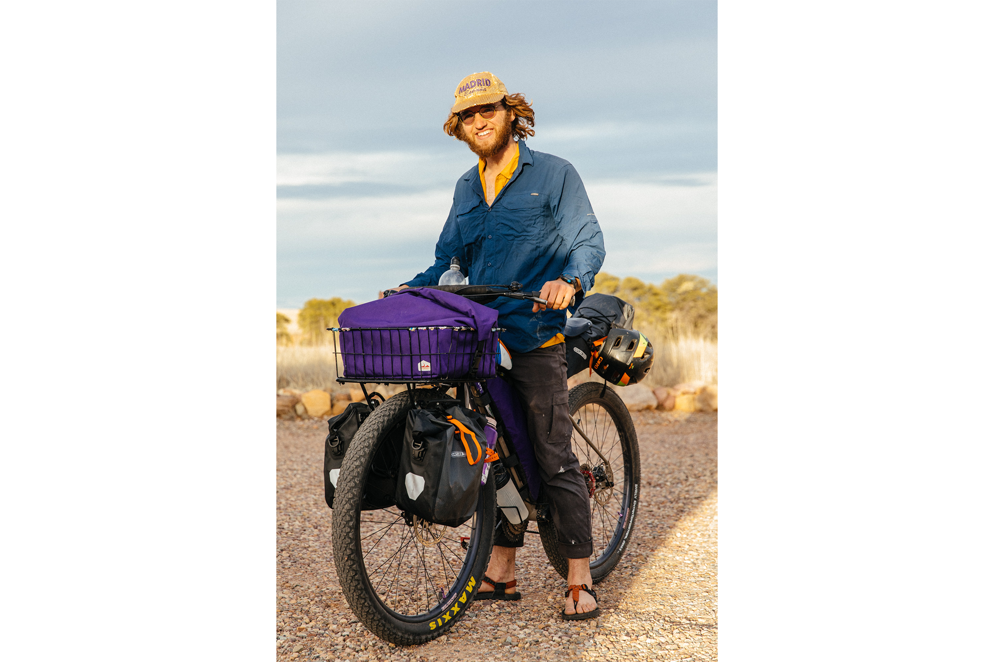
After a chilly evening, Julia and Ty made espresso drinks, along with Benedict’s breakfast cuisine. Shortly after, we were all packed up and ready to roll for the 7 am start. I opted to drive the course, after nursing a pulled back muscle, tweaked the week prior, and was lucky enough to have Rue, another fellow photographer, as my co-pilot. The racers lined up and stared down the 120+ mile route, with 8,000′ of elevation, and with one last breath, they took off towards the Santa Rita Mountains.
Having ridden 85 miles of this course the week prior, I already had a rough catalog in mind of where the ideal spots would be for shooting, so I was taken by surprise of the sheer beauty along Solero Canyon road, an area I had yet to explore on the first trip. With each turn, Rue and I would psyche ourselves up with interjections of stoke. The clouds, the light, the landscape – it will resonate with me for years to come.

After the ripping descent from Box Canyon, the route followed a frontage road before heading towards Mount Wrightson and Solero Canyon Road, the sleeping juggernaut of a climb, and the gatekeeper to Patagonia, the last stop for food and provisions on the route. We tailed the front pack for the most part, catching glimpses of the top four racers as they ripped down the rutted and rocky 4×4 trails.
Once we refueled in Patagonia, we had a mission, to catch up with Lael and follow her back to the ranch… Joshua Berry finished first with a time of +/- 6.5 hours. Lorde Adam came in second, and Lael third.

Slowly but surely, the racers and riders of the Ruta del Jefe trickled into the Research Ranch, where they were greeted with a post-ride recovery smoothie and dinner tacos, whipped up by Ultra Romance. Come 9pm, David from Golden Saddle had a mechanical, prompting Locke to drive to Patagonia to retrieve him from a local bar. Locke was a true hero during the event, helping out across the board. I stayed up until 10pm or so, when we got the word that three racers had decided to camp on course, building a small fire to stay warm. They eventually made it back safe the next day.
All in all, Ruta del Jefe brought to the forefront the issues threatening this wonderful, sacred land, in an engaging format that offered a substantial challenge to entrants and opened the door to more exploration by bike in the Santa Rita Mountains and San Rafael Valley. You could also choose to tour the route. Head to Ride with GPS for all the details, including waypoints.

Also, check out the page at BikeReg for more informative links to read about this event and the issues surrounding the land.
These images and more are at my Dropbox. Feel free to download them for personal use.
____
Follow Sarah on Instagram and see more photos at #RutaDelJefe.
