


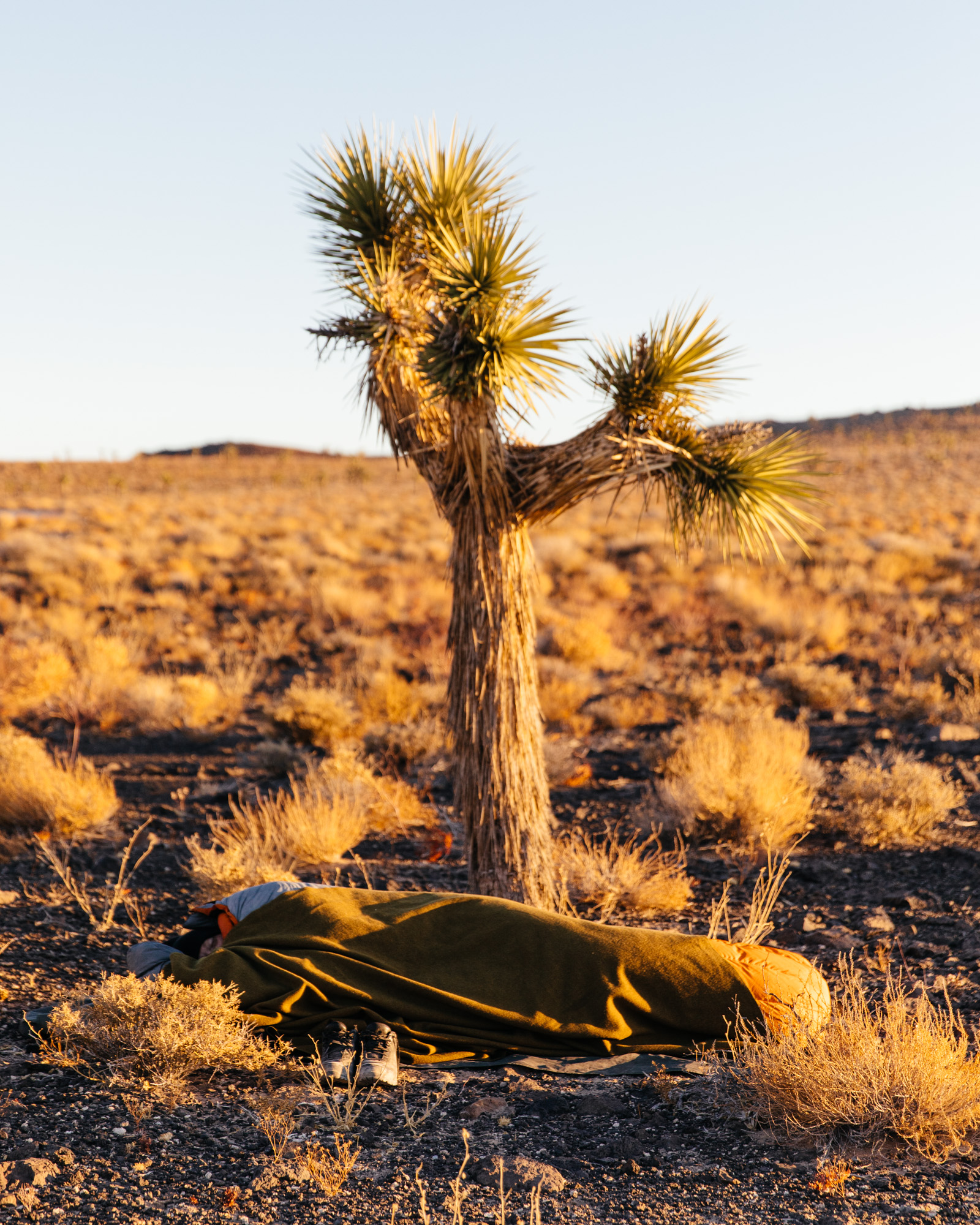


The cold. Oh, the cold. Never before had I experienced 10º temperatures at night and 70º during the day. There I lay, in chrysalis, asleep in my bivy thinking to myself, “this is miserable.” That was two years ago, at the foot of the second tallest sand dunes in North America, nestled between the Last Chance and Amargosa Mountains in Death Valley National Park. Needless to say, it took a while for me to want to tour this unforgiving place again. There’s something transformative about touring in the Mojave Desert. The dryness, the elevation, the sand, the silt, the wind, the washboard roads; insurmountable obstacles really bring out the truest human condition, that Lovecraftian urge to get out and test one’s limits. Push it a little bit further and come out the other side. Had I known that this love for the deserted, the dusted, and that grandiose dolomite was merely biding its time as I shivered uncontrollably in my bivy sack two years ago, I might not have been so absolute in my cynicism. It was time for emergence.
“If one is inclined to wonder at first how so many dwellers came to be in the loneliest land that ever came out of God’s hands, what they do there and why stay, one does not wonder so much after having lived there. None other than this long brown land lays such a hold on the affections. The rainbow hills, the tender bluish mists, the luminous radiance of the spring, have the lotus charm. They trick the sense of time, so that once inhabiting there you always mean to go away without quite realizing that you have not done it.” – Mary Hunter Austin, the Land of Little Rain, 1903
A swing and a miss left me by myself in the Long Valley Caldera last month, without my fellow desert rats. Not that I minded the desert solitaire. I brought a book and found time to build up my confidence for bike touring in the desert. After that ride, I really wanted to get back into Death Valley. Coincidentally, the Mojave Desert Land Trust reached out to me along the lines of “hey, we like your Death Valley bicycle rides, care to do another this fall to commemorate the California Desert Protection and Recreation Act?”

California Desert Protection and Recreation Act
25 years ago, Congress found that federally-owned deserts of Southern California were a resource no price tag could ever be affixed to. These lands were on the brink of being auctioned off, sold to the highest bidder, to be removed from public enjoyment for generations to come. They make up a public wildland resource of extraordinary and inestimable value for current and future generations. Their scenic, historical, archeological, environmental, ecological, wildlife, cultural, scientific, educational and recreational values are as such that future generations should be able to experience them in their mysterious wonder. Congress declared as its policy that appropriate public lands in the California desert must be included within the National Park System and the National Wilderness Preservation System. Within this sector, the forming of Death Valley National Park was solidified.

Death Valley National Park
Congress made various findings related to the importance of solidifying, enlarging, and protecting the Death Valley National Monument, which was originally established in 1933. Since that time, the Mojave had changed a lot. Mineral extraction, OHV, and other threats were encroaching on these delicate lands. The 1994 Act abolished the monument and incorporated its lands into a new Death Valley National Park, under the control of the National Park System.

Timbisha Shoshone
An unfortunate byproduct of this move was to negate, to delete, to erase, and further colonize the lands by choosing the name “Death Valley” as an homage to the Jayhawkers, a group of prospectors looking for a short cut from the Great Basin to the Sierra. They almost perished completely by traversing the lonesome graben, in only a matter that the uneducated, the egotistical, and the Anglo-European would so flippantly proclaim their domineering prowess, desire to conquer, and with no reverence. As they left the valley, one of the survivors turned and said: “goodbye, Death Valley.”
What the Jayhawkers did that fateful trip in 1849 was something the Timbisha Shoshone figured out long ago. In the summer months, these native desert peoples stayed at higher elevations, gathering piñon nuts, juniper berries, and hunting various fauna amidst the craggy peaks. While in the winter, the valley floor became their home. They lived in symbiosis with the land and it’s one of the biggest blunders of the naming of Death Valley National Park to not honor their homelands.
Just when we think we’ve done something positive for the lands, we’ve erased the people from its namesake. The Timbisha Shoshone Nation has a reservation within the National Park, as well as outposts in Darwin, Keeler, and throughout Owens Valley where they are currently working with the Paiute Nation to de-colonize the lands from the LADWP, various recreation groups, and other resource-aligned agencies.

Just recently, the Senate passed a bill completing the effort to protect our California deserts.
“This bill is the completion of a 25-year effort to better manage the California desert. It fulfills the promise I made to off-roaders and environmental groups that we wouldn’t stop with the 1994 bill. More importantly, it shows that by working together we can expand protections for this region while ensuring it remains open for all visitors to enjoy.
Teeming with life – from desert tortoises to bighorn sheep, breathtaking wildflower blooms to iconic Joshua trees – few places rival the unique beauty of California’s desert. The desert is a defining part of California’s landscape and we have a responsibility to preserve it for generations to come.” – Senator Dianne Feinstein
History Repeated
For those interested in the geological, anthropological, political, and other information of these regions, I highly suggest thumbing through the following Reportage files: Three Mule Team: Bikepacking in Northern Death Valley – A Prospector’s Tale, Cycling Through History in Death Valley National Park, Into the Inyo Mountains: Disconnecting in Cerro Gordo, and Into the Caldera: the Bishop Volcanic Tablelands Overnighter. Within those pages, there is ample historical information surrounding the following route we embarked on.

Cast of Characters
I think the initial outreach was around 10 or so people, observing the rule that on trips this ambitious, the group will auto-cull to a more sustainable size. Sure enough, due to scheduling conflicts, we ended up with a solid group of six total. My attempts at diversifying the group were thwarted by adult responsibilities and it was, unfortunately, looking to be a dude party – until Al threw her hat in the ring – fortunately. Her account of the trip is something I am honored to have within this Reportage and it follows…

Al’s Account
I am not a seasoned bikepacker. I think that’s important to clarify at the outset, but I relish a good physical and mental challenge.
I’ve been backpacking, camping, hiking, biking, and exploring the outdoors for my entire life, but the idea of bikepacking wasn’t something that inspired me until recently. I liked backpacking, and I liked biking, but I liked them separate. They served distinct purposes for me and I won’t delve into the psychological root of this reasoning. But ultimately, my appetite for a challenge and my desire to escape to very remote places are what led me here.
I think we overcome the greatest challenges (and consequently become better humans) when we have no choice. Sink or swim: to succeed or fail completely by our own efforts. Life can, despite our resistance, deal us these kinds of situations, or we can construct them – we can impose upon ourselves these ultimatums of success or failure, of no other way out but to complete a goal. Riding into the middle of Death Valley on a bicycle is an example of the latter. A kind of self-inflicted ultimatum to push through the pain and emptiness and make it out the other side, back to the truck and water and cell service and all the other comforts of civilization, alive. Quitting midway through is not an option. I find this both satisfying and fun.

So, when I had the opportunity to join these five amazing humans on this ride, I was ecstatic. The Mojave Desert, and Death Valley, in particular, is a profoundly beautiful and special place to me. I grew up in the damp, cool forests of the Pacific Northwest, in the shadow of Mount Rainier, and descending into Death Valley truly feels to me like landing on another planet.
The desert has captivated me. The smell of creosote and dust. The jagged volcanic rock, its history beyond our comprehension. The almost unbearable heat of summer that burns the lungs with each inhale. The Mojave is an inhospitable place for us humans, but host to so much unique and beautiful life, most of which are never seen by people passing through in air-conditioned cars. To truly experience Death Valley, it needs to be visceral and it should be uncomfortable.

Death Valley has long appealed to the adventurous, the unconventional, and what many people consider the “crazy” (we were called “crazy” more than once over the course of this trip). Death Valley feels both terrifying and limitless and opportunities for self-exploration and introspection abound.
To focus, through the tired muscles and the washboard-battered body, on spinning circles and pushing forward, is one of my favorite meditations. The ineffable vastness of the landscape, the feeling of being so small, lends itself to taking the kind of internal journey that has a radical and lasting impact on the soul. And when six people undertake this kind of arduous external/internal journey together, the sense of interconnectedness and camaraderie forges a profound experience – the kind that serves as a grounding reference point as we return to the routine of our daily lives. – Alison Malsbury

Radavist Reportage – Day 01: Across Lee Flat and Hunter Mountain
Having ridden this route before, twice, albeit in the opposite direction, unloaded, I had an idea of what to expect. A water caching mission is how I spent my day prior to this trip, where I drove our route in my truck, stashing 7-gallon water jugs and firewood bundles adjacent to our ideal camping locales. I returned to our rendezvous point to find Erik Nohlin riding practically naked in nothing but his shorts down the dusty road. We set up camp, caught up, cooked dinner and waited for our crew to assemble as the light faded and cast an oh so familiar ombré fade across those mystical Joshua Trees, the lilies of the desert.
Colin Frazer and Adam Sklar arrived as the sun dipped behind the Inyo Mountains and the temperature dropped. I was in bed by 8 pm and up at 5 am, ready to roll. Sean Estes and Al Malsbury arrived in the morning, just as it began to warm up. They had driven in from San Francisco the night before but stayed 45 minutes away at a hotel in the interest of getting a good night’s sleep. Their plan was to bring their pup Wiley along on the trip, just adding to the fun.
We rattled off a list of essentials; “someone have a Dynaplug? a pump? do we need a filter? what about spare tubes?” It’s this cataloging that gives me the most anxiety. “I’ve got my InReach!” Emergency protocols covered we stared across the valley and began to climb.

Hunter Mountain was our main feat for the day, after traversing Lee Flat, one of the densest Joshua tree forests in the Mojave. 25 miles of climbing was on the agenda and with the sun setting around 4:45 pm in the valleys, we had to cover a lot of ground and elevation before we could enjoy time off the bike. The day prior I had encountered many outdoor recreationalists in their vehicles – more than I had ever seen in Death Valley before – so I warned the group about staying safe by not cutting the corners on turns and listening for the hum of engines. It would be a busy weekend in the desert.

Arriving at camp, with minutes of sunlight to spare, our group quickly took over the talc mine, noting its uncanny ability to reflect the blue hour light and warmth as the temperatures began to plummet. Two bundles of wood last about as long as your mental state in these conditions. Hydrate, replace lost calories, and zone out.

Closing one’s eyes in the moonlight send electronic signals to the extremities. Toes connect to the fingertips as the legs pulse. It had been a big day. The furnace that is my stomach begged for more food and my mouth dried immediately. 2 liters later and a midnight watering of a neighboring creosote bush – which thanked me with an aroma so pleasant it almost masked my ripe odors – I was finally ready to fall into a deep sleep. As quickly as it came, the sun rose, as the landscape illuminated. Soak in the warmth.

Day 02: Hidden Valley to Homestake Dry Camp
A warm blanket of solar energy envelops our camp. It was a cold night. My bottles are frozen but the embers in the fire take little convincing to awaken. Coffee. Breakfast. Laughs. After a full day of climbing, our agenda included lots of downward-trending, yet sandy and rough terrain await. We pack up our camp and begin to roll out, slowly shaking the previous day’s lead from our legs. It doesn’t take long to feel the air warm as layers shed and the heat cranks up.

This day is without a doubt the most scenic. Hidden Valley is caressed by swooping escarpments of dolomite, as striped buttes, canyons, and mountains envelop the silty drainage and the road truncates alluvium that has taken millions of years to erode. The National Parks Department grades this road frequently as evident by the embankments on either side. It’s a fast-paced rat race down to Teakettle Junction, a landmark adorned with traveler’s own kettles hanging from a sign marking destinations to the north, south, and east. We stop for a second to snack as a convoy of 20 Jeep JKs roll up on our group, looking as puzzled at our presence as we are by the sheer number of vehicles in their group.

Coincidentally, we would travel faster down the 10 miles of washboard to the Grandstand – a monzonite boulder grouping seemingly floating atop the Racetrack Playa – a dry lake bed. As we rolled up and off the side of the road, the convoy passed us, coating our persons and bicycles with dust. They drive as if we’re not even there.

Groups of 4x4s continue to trickle down Racetrack before turning onto Lippencott as we watched dozens of trucks caress the pass with grace and agility only possible when observed from such a distance.
An hour or so is spent lizarding on the cool rocks in the scarce resource that is shade in these open “Big Country” landscapes. The long and low winter light is on our side here. Once substantially rested, we continue onward along the four miles to our camp, the remnants of the Ubehebe Mine, at the base of Lippencott Pass. Camp is made, as we each embark on our own spiritual journeys thanks to our suggestive catalyst of choice. Geometric patterns emerge in the arid landscape as creosote shadows dance along the hillsides and the valley floor comes to life. A high ridge becomes our chapel as we pay homage to the sun, the expanses of the Inyo Mountains curtaining us from its eventual resting place for the evening. The light. The sounds. The entire valley’s flora and fauna exhale as the cooler temperatures and darkness envelop our band of desert travelers.
We have a big day ahead of us and after our wood is burned through, we crawl into our shelters, ready to be frozen in a thin veil of ice. Our physical state has been heightened by the metaphysical energy of this wonderous environ.

Day 03: Lippencott to Saline Valley Road
On older maps of the area, pre-WW2, Lippencott Road is called Ubehebe Mine Road. Many of these 4×4 Jeep trails were originally cut into the mountains for ease of access to minerals. In modern times, it is one of the few roads of consequence in the park, although, in my time in this area, I have witnessed vehicles tipped on their backs on seemingly flat and calm roads. It doesn’t take much for things to go awry out here. Especially with many people ignoring the park’s warning signs in lieu of their Google Maps directions ensuring them it will be ok. Siri wants you to be stranded.

The thing is, it never fairs well for wayward travelers unaware of what awaits. Earlier this month, a 4×4 pickup truck lay stranded about a mile from the top of Lippencott with four flat tires, closing the road to vehicular traffic. How the occupants got out safe and sound is a mystery, yet this story is far from rare. Many vehicles have tumbled down from the bench cut road into the wash below. All it takes is a second to forever alter your life.

On bicycles, however, Lippencott Pass is one of the most enjoyable stretches of the tour, with rock gardens, exposure, and views to take your mind off the rock-tumbler rattling of your bike’s contents. While it is doubletrack, there is but one suitable path for a bicycle. Pick your line and hold on! Halfway down, we all paused to take in the magnificence and point out our path across the valley to Saline Valley Road, our final path for the trip. Awaiting us was a substantial climb. The kind of climb that you can see for miles and seemingly takes all day to complete. Halfway up, we took to the shelter of a cottonwood tree in the canyon, as the term “wabbitbwush” was coined for our gilded friend the golden candelabra of the autumnal equinox, rabbitbrush.

A constant trickle of 4×4 and moto traffic passed us. Witnesses to the spectacle that is self-supported bicycle touring in the remote desert, much less a place called “Death Valley”, were more prevalent on this trip. As such, we got “y’all are crazy!” a lot.

We are crazy.
To say we were all a bit shelled is an understatement but the glory of the descent back to our vehicles quickly erased our self-doubt, parched pallets, and hunger. I fixated on the cold beverages and warm meals that awaited us and like a stream of flying jets, we got into formation and tackled the last miles in complete silence, with the desert whispers soothing our broken bodies.
Route Information
We are not in the business of planting flags and calling routes our own since we are not the owners of the land. That said, here is the route we took for this trip. Natural water sources (you should filter), suggested camping, and hazards are marked. It’s recommended to cache water on this route, which can be safely done in any 4WD vehicle by entering Hunter Mountain and driving to the second night’s camp and returning. Be advised, the North Face of Hunter Mountain can be icy in winter months and the roads eat tires alive. Be prepared. Be safe. It is not advised to take Lippencott Pass unless you are an experienced 4×4 operator. Be respectful of the life both visiting and found in these desert lands and observe the Leave No Trace Principles. Please, pack out your toilet paper and be sure to bury any human waste 6″ deep in the soil, not in drainage or a wash. Take only photos and leave only tire tracks. Shred lightly.